Stage 3: Königstein – Kurort Gohrisch

Discovering Königstein

Neue Schanke had been our base all evening. In fact, it was not possible to just explore the village itself. We always had to do that by climbing the bit to the castle and then descending considerably. On the third walking day, however, we would do this as part of the route, after a breakfast in which artistically cut sausages stole the show.

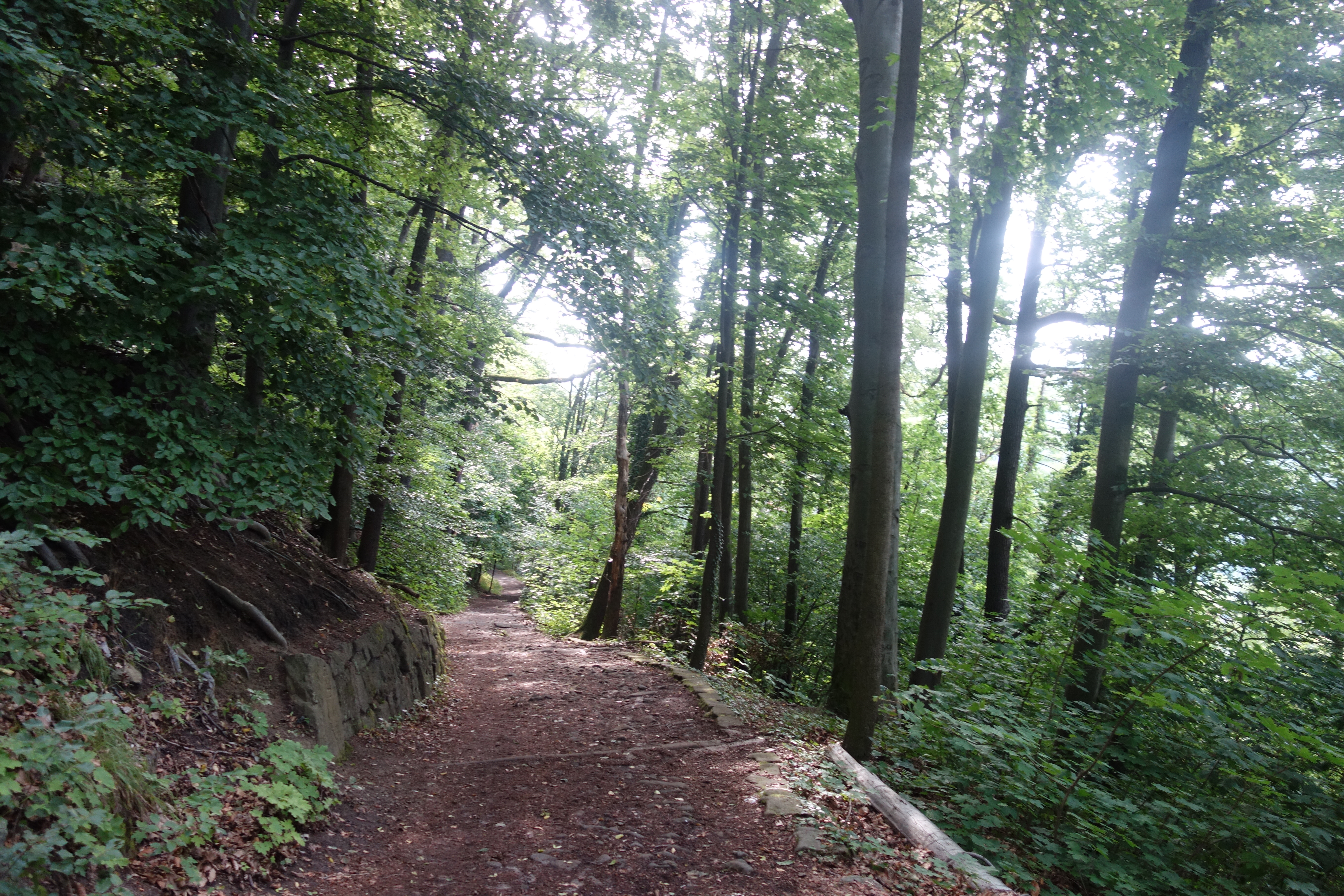
So after checking out, we had to climb again and then descend quite briskly through a forest. So we arrived in Königstein which has quite a pleasant centre. It made it extra unfortunate that we should have spent the night on the other side of the hill. Anyway, we could stock up on provisions for two days here and take a sanitary stop. I did suddenly fear that my glasses had been left behind in our previous stay, but returning was not really an option. It was waiting for luggage tonight.

Another Malerweg icon

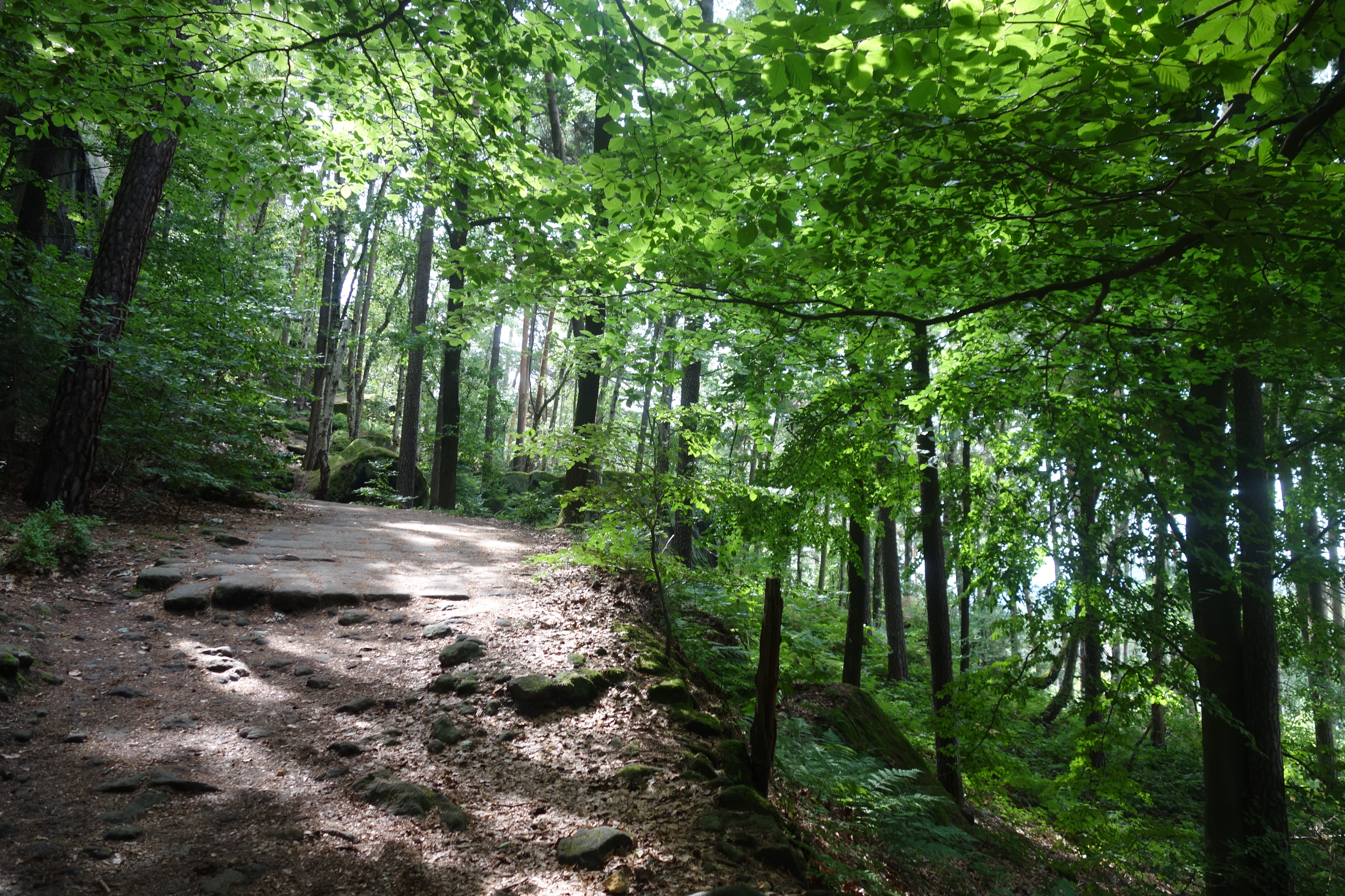
Once out of Königstein, there was immediately a steep ascent, first along a small local road, then again along a forest road and so to a forest, where we would spend quite a long time on this short hike. The narrow, winding path led past rock formations and hilltops with names like Kletterhöle and Quirlwachter, as well as a stone drinking trough. Then the forest was briefly abandoned before heading to the highlight of the day, the Pfaffenstein massif, not much later. The way towards it was already accompanied by an increase in jagged and imposing rocks and formations.

And we could feast on a triptych of natural entertainment. First was the side trip to the Barbarine, a 42-metre-high rock needle and local darling. It required some searching but fortunately we did not miss this gem. Perseverance won out in this one. The road to it was also via a first narrow gorge.

Rocks and descents

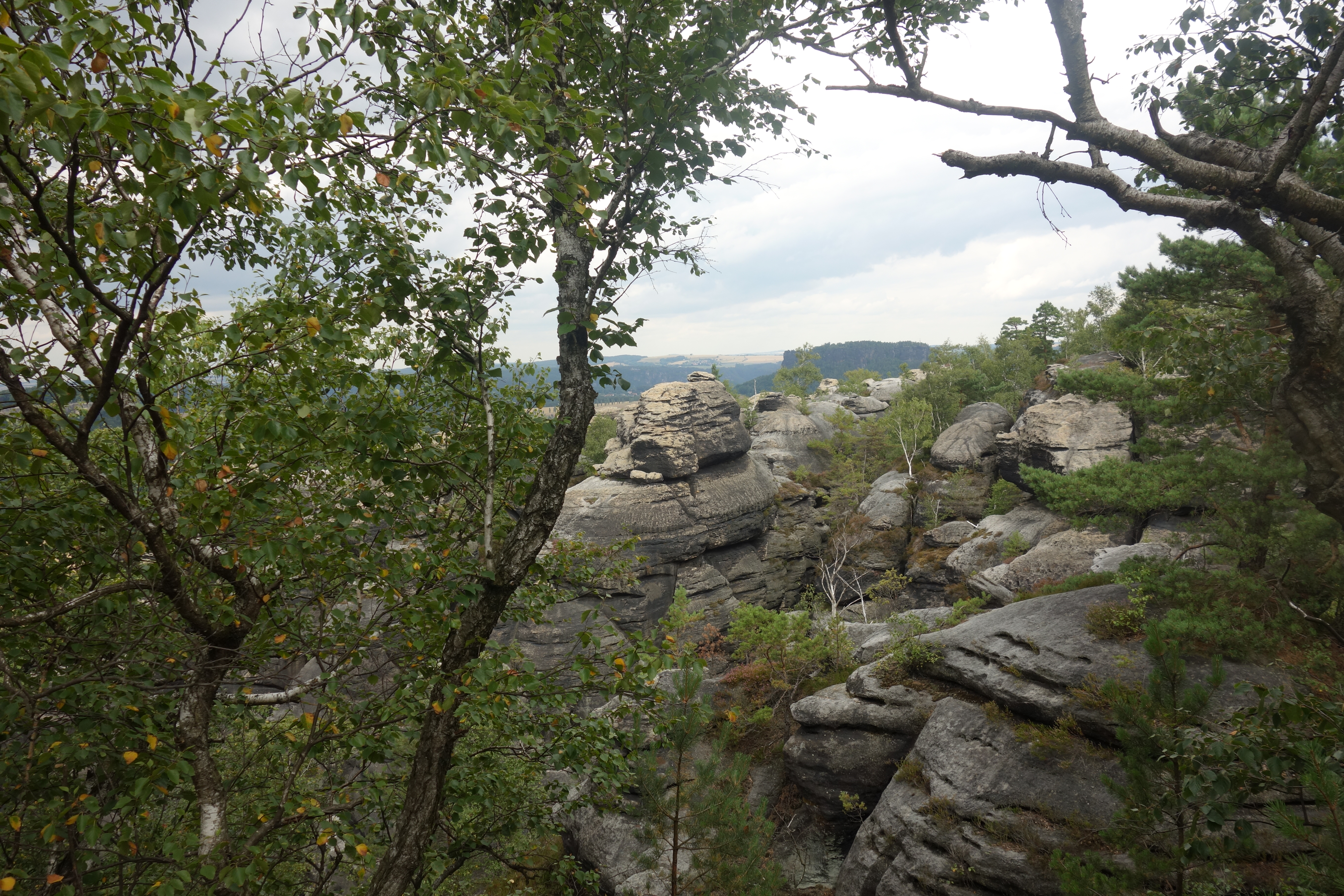
Once we returned, we had two options. Option 1 was an easy descent, option 2 gave us panorama but, according to the guidebook, also a tough descent. We opted for the full experience and thus chose the latter. After doing some climbing and passing the local hospitality spot on the plateau, we did a tour of the panoramas of all kinds, including the Teufelskessel, the Dom and the Einsamer Ritter. It also turned out to be a good picnic spot. What did stand out were the many young parents and very young babies who also ventured the hike.

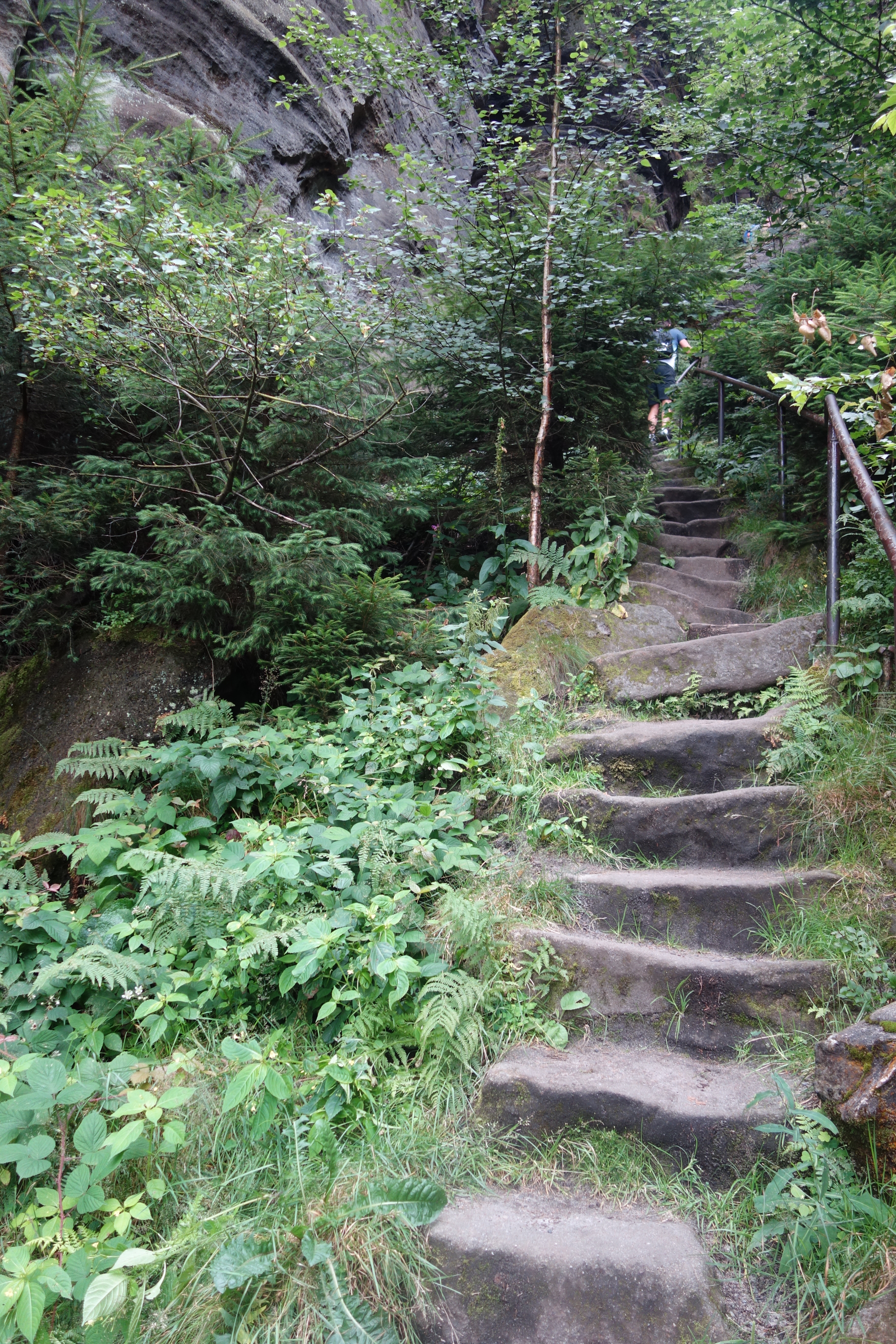
Then there remained the descent along the so-called Nadelöhr, a bottle neck that required a ladder and steep iron steps for a while. I managed to wriggle through with some scraping of the rucksack. The sections after that were relatively challenging due to the height differences of the stones and steps, but rather traditional in terms of descent skills.

A spa town with limited restaurants

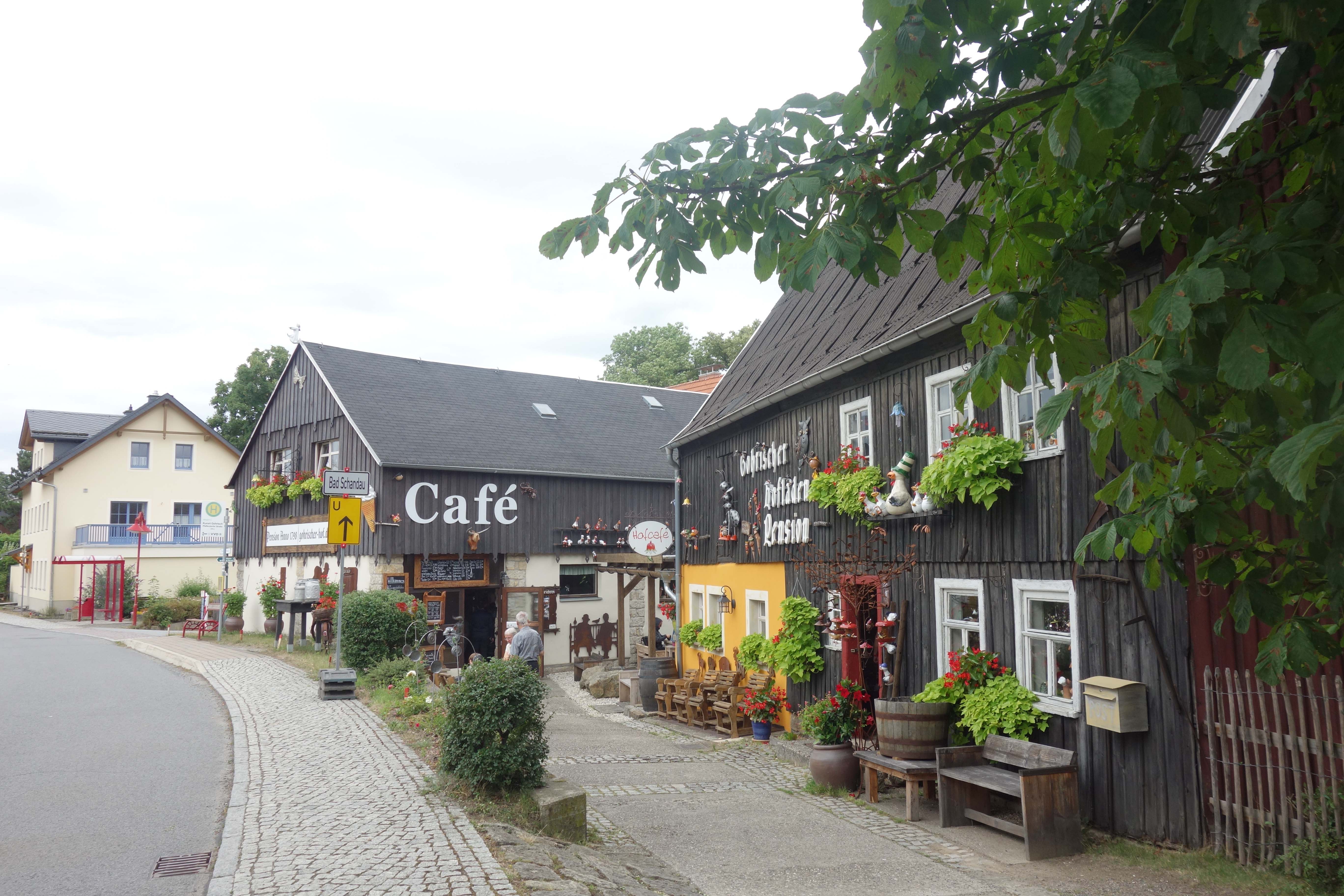
We descended further to Pfaffendorf, a small cosy village, and finally to Kurort Gohrisch, equally cosy, slightly larger, but also with many lodgings and little catering. Luckily, we stayed at Pension Villa Irena, where they were helpful enough to make reservations for us. Just before, we had also tried our first (and only) ice cream.

Eventually we made our way to Margaretehof, a cosy restaurant belonging to the hotel of the same name. We ventured in for a starter (goat cheese croquettes and mushroom soup). For the main course, we took the local speciality, Bohemian goulash with knödelen. It was tasty and the service was friendly. I unintentionally surprised the waitress by accidentally giving a twenty euro note instead of five as a tip. Fortunately, she was honest enough to say that was really too much.

Find more walks on Malerweg here: https://seatothelandbeyond.wordpress.com/malerweg-and-sachsische-schweiz/

Stage 2: Kurort Rathen – Königstein

Today, some pre-announced highlights were on the menu. Our experience yesterday taught us that this meant paying attention for the motivated day tourist. That was certainly the case for the iconic Bastei Bridge. And so it was a case of leaving early enough. After an early breakfast, we were able to leave Rathen behind them at a little after eight.

The Malerweg icon and a special castle ruin

A short climb took us to the Bastei Bridge, with stunning views of some impressive rock formations and the surrounding landscape. Upon arrival, there were barely any people to be seen. Ten minutes later, the situation was already very different. Our choice strategically turned out to be the right one. This allowed us to enjoy this highlight, where you feel very small and insignificant on the large bridge in this impressive landscape.

Our hiking description then sent us to the soulless catering complex, although it seemed to me that we still wanted to score a panorama of the bridge somewhere. So we turned back and got the familiar breathtaking view that graces many a promo photo. Of course, it’s not always about the photos and panoramas, but this one was incredibly beautiful.

While we were at the bridge again, we continued a little further towards our starting point, where the remains of a startling castle stand. The Neurathen ruins could be visited via a tangle of steel bridges, some with a bit more precipice than others. In any case, it was a short but enjoyable visit to a handsome piece of castle architecture embedded in the rocks.

Even more fairytale-like

After both these small but more than justified sidesteps, we went past Bastei again and so somewhat away from the tourist feeling, until we reached the Steinerne Tisch, where the German explanations vaguely said something about Electors and hunting traditions. The collection of stones could certainly offer a suitable picnic spot at another time, but we were only just on our way.

Then followed a passage reminiscent of the bit after Hohnstein, only it was all even grander, cleaner and more majestic. Rocks towered above us, often mossy. Impressive tree trunks lay snapped on the ridge. Almost every rock was photogenic. It was quite a (nature) experience to walk here.

A second castle and a rocky table mountain

A short stretch of tarmac took us to the cosy little town of Stadt Wehlen. Here, too, we could walk past remnants of a castle. Although this one was slightly less well preserved and its location and views were a bit less spectacular. After a short break in Wehlen’s market square, we took the ferry. Contrary to expectations, our hotel guest card was not valid on this ferry, which was made rather unfriendly by the driver (with two “neins”). So we paid €1.80 each for a trip of no more than 30 metres.

A second castle and a rocky table mountain

After briefly following the Elbe on the other side, it was climbing again. At first it seemed to be a modest continuation by local hiking standards on a pleasant forest path. But that was without counting the passage over the table mountain Rauenstein. The hike took us over and between rocks with stone and iron steps and rocky passages, occasionally aided by a railing.

The number of day tourists made it clear that this was very popular, but then again the views were phenomenal. After a longer stretch of iron steps down, it was on a wide path between meadows to the small village, Weißig, which served as the lunch spot of the day today.

This was followed by a second stretch of field road, with fragrant flowers, and another forest path that led past a small mausoleum and a viewpoint. The small village of Thurnsdorf was still crossed on the way to our final destination of the day, Königstein and the fortress castle we had been able to observe several times in the distance.

The fortress and the remote residence

There we arrived via an ascending forest path, a busy car park and our hotel Landgasthof Neue Schanke. The fortress looked impressive on the rock and we had been able to admire it from all sides from afar. Inside, it was gigantic and sometimes a little lost, although there were some specific highlights such as the mural in the little church, the frivolous schloss Frederick, the deep well and the ever-growing wine barrels (which did break down quickly). Still, it was a bit too pricey.

And on leaving the castle, it suddenly started to rain heavily. We were able to wait a while to make it to the hotel relatively dry. It is located on the other side of the hill and thus somewhat away from the village itself. Therefore, and also because of our fatigue and our modest midday meal, we decided to have the local snack. The schnitzels with fries were not too high quality but it was filling. And that there was a dead wasp in my glass, expertly removed with a spoon by the cook, we will just turn a blind eye.

Stage 1: Bad Schandau – Kurort Rathen

After a few days in Germany, we started the hiking part, the first part of a five-part journey. So first it was down to an early breakfast to get us well on our way. Some more shopping later, we were able to set off on the hike, a good 20 kilometres (+- 12,5 miles).

Fields and views

A good start is half the battle, and so we immediately climbed up a short but sturdy path, first paved, then through a patch of forest. Bad Schandau was soon left behind us. Not much later we arrived on a plateau overlooking the Lilienstein rock formation and our destination for tomorrow, Königstein, with its imposing fortress.

Then it was onto two small villages. We reached Rathmansdorf via a small forest path. Before reaching Porschdorf we first climbed up, away from the road, before descending briskly. Here we saw a bridge under construction, which again made us wonder why they don’t build bridges over the Elbe, opting instead for the ferry.

A beautiful path and hundreds of steps

Shortly after this second village, we followed a path with many small steps, bridges and tree roots, which kept running parallel to the road. On our left, however, rocks and trees began to tower above our heads. This was just a taste of our climb for the day. According to our guide, we had to overcome +- 800 steps to reach Brand, thereby and good 150 metres ascent.

The section after that first went along a gravel path between the trees. But from then on we were finally following the Malerweg trail. After a short while, we saw noticeably more hikers (but 99 % saw them in the opposite direction). The forest environment became more impressive, with larger rock formations and deeper slopes. We also saw the Drakenkopf, a rock reminiscent of, well, a dragon’s head.

After some more winding through the forests, we decided to visit the village of Hohnstein and eat our midday meal there. While the village was cute, it was less idyllic than we had imagined based on the sound of bells in the forest. Above us, Schloss Hohnstein towered high above the houses. But as we still had quite a bit of walking to do, we left that climb for what it was.

Fairytale natural beauty

The first part was beautiful, but from Hohnstein the natural beauty really began. The rocks and wooded hills were now accompanied by streams, waterfalls and even once a romantic-looking bridge above our heads. A fairytale scene. Out of the forest, we came into Polenstal, which seemed to consist only of a guesthouse.

Another highlight soon offered itself. The stairs surfaced again. At first this was still a combo of wood and earth, a little later wood and then we had to climb an iron staircase through a narrow gorge. Getting to the entrance in particular was a bit of a wriggle even with our modest daypack. I wondered what arts and crafts would be needed with a full-sized trekking backpack.

After this, we arrived at the Hockstein, a plateau overlooking the surrounding area, including the village of Hohnstein and its castle. The last part of the hike was an easy path through the forest. The exponential increase in fellow hikers betrayed the proximity of our final destination.

Recreational lake and a small panorama

This one started with a passage at Amselsee, not an idyllic lake but a paradise for water fun, with lots of rowing and paddle boats. Another half kilometre later we arrived in Kurort Rathen, popular as a base for the famous Bastei Bridge. The many tourists already made that clear.

We decided to take a little diversions to the little Bastei, a viewpoint to the other side of Rathen, the Elbe and again the Lilienstein and a bit of Konigstein. After this extra outing, we went to our hotel Amselgrundschlossen. Not much later, it started to rain heavily. So we could not complain about the pleasant hiking conditions of the day. And it continued to do so throughout the evening. Fortunately, we could make reservations at our hotel and the rain was mostly a plucking in the background. Though the question was how that would translate on the trail the next day.

The accommodation

Hotel Amselgrundschlossen is a cosy hotel that fits perfectly into the spa surrounded by greenery and rocks.

The food

We both took fried chicken with croquettes and a paprika sauce. Pretty tasty. And we allowed ourselves apple strudel in addition.

Malerweg and Sachsische Schweiz: What?

This summer, we did a piece of Europe that had long been on our to do list, Saxon Switzerland, which includes the famous Malerweg hiking trail (the painters’ trail, more about it later). Saxon Switzerland is in (surprise surprise) Saxony, in the eastern part of northern Germany, near the Czech border. It is known for its specific natural beauty.

Stunning scenery

The core of Saxon Switzerland is demarcated by National Park Saxon Switzerland, which is complemented by National Park České Švýcarsko, Bohemian Switzerland, where a similar landscape and geology can be found. It was created by erosion on the former sandstone mountains, which originally lay beneath the seabed. This erosion gives you the unusual rock formations and massifs that characterise the landscape.

Inspiration for artists and attraction for tourism

The landscape is not only appreciated by hikers. It was also popular in the 18th and 19th centuries. At first it was popular with a whole host of painters. The most famous of these is undoubtedly Caspar David Friederich and, in his wake, other artists such as Johann Christian Dahl and Ludwig Richter. They were inspired by landscapes. Sunlit and misty, day and night, but always experiencing and honouring grandeur.

Tourism also came early on. Both in the villages and on the hiking trails, there are several witnesses to its popularity from the 19th century onwards. This is not just about the obvious hiking culture, but also hotels, restaurants and cafes boast a long tradition that dates back to the 19th century. Walking, painting and climbing are indeed contained in the local DNA here. And then there are the villages that boast the “spa town” label.

The Malerweg

The Malerweg is around 115 km and pretty much a loop with a few more kilometres to the starting and finishing points, which are a little bit apart. It is a relatively short walk, but does have some altimeters, so it’s best to take a bit longer over a smaller number of kilometres. For the sake of tourist appeal, the various villages and towns are equipped with lots of hotels, B&Bs, campsites and restaurants. The villages are close together and connected by a railway line. What is special, pedestrians do not take the bridge over the Elbe. For that, several (very) local ferries are provided.

Our trip

We booked our trip again with a travel organisation for convenience. The advantage, besides being unburdening, is the fact that luggage transport is again provided. The first day of the trip starts in Dresden. As that is a long train journey, we decided to provide a stopover in Hannover. We did the same at the end, in Frankfurt. We hiked 4 days (pretty much all of them) on the Malerweg and there is also a fifth hiking day in Saxon Switzerland, to the highest point.